The Giant of Provence: Climbing Mont Ventoux
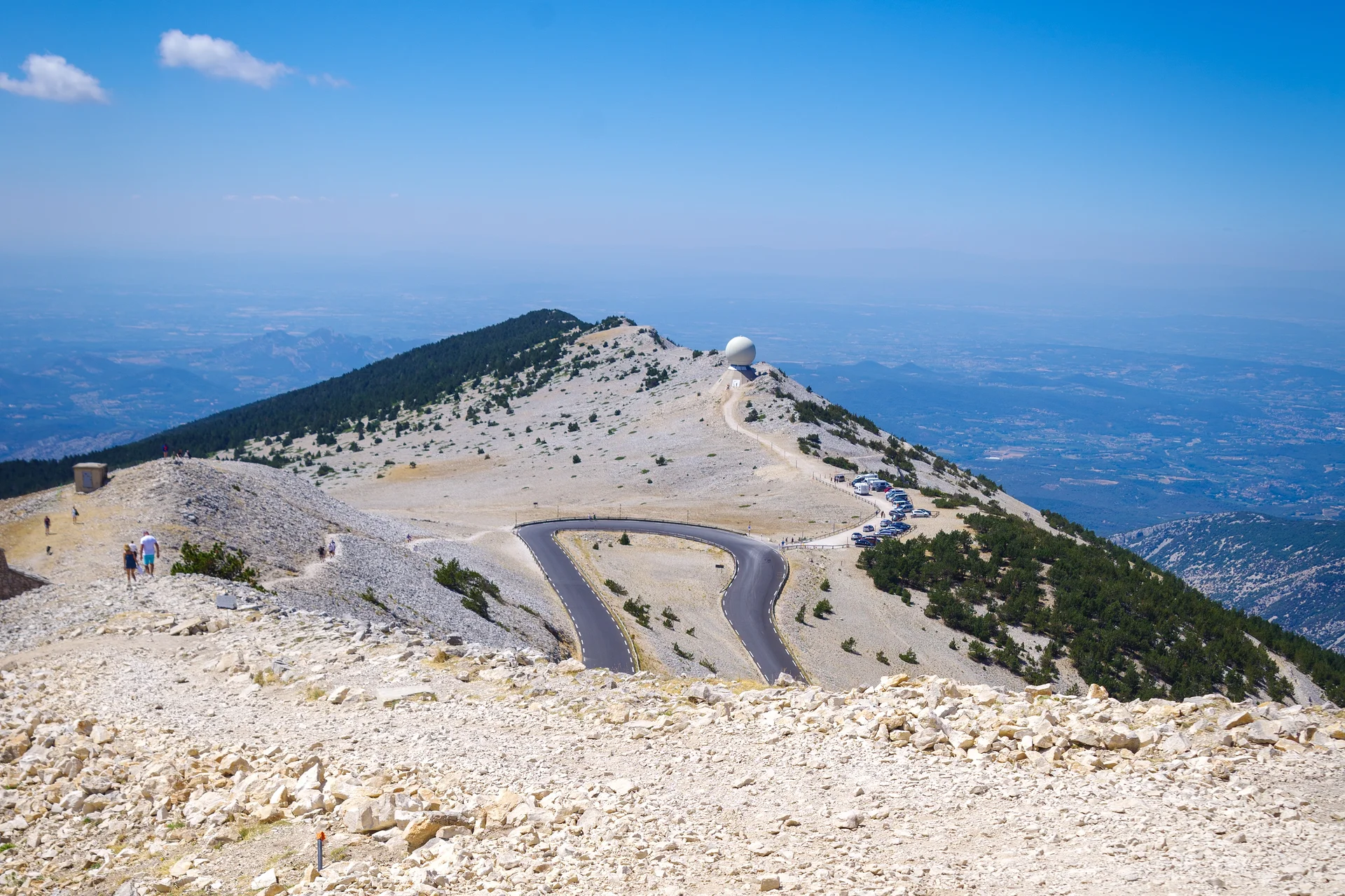
At 1,910 meters (6,266 feet) above sea level, the wind here is strong enough to rip your hat right off. A lunar landscape of white limestone stretches out in every direction, while the silhouette of the Alps rises in the distance. Further down, the Mediterranean sea sparkles on clear days. This bald summit, which towers over the Comtat Venaissin plain, has fascinated people for centuries.
Why climb Mont Ventoux?
The Giant of Provence has been recognized as a biosphere reserve by UNESCO since 1990. This designation highlights a rare phenomenon: on its slopes, Mediterranean vegetation grows right alongside alpine species. You will find lavender and holm oaks at the base, beeches and firs midway up, and finally a rocky desert where plants typically native to the Alps thrive. This biological overlap is due to the mountain's dramatic elevation gain, as it sits isolated among the rolling Provençal hills.
The poet Petrarch made the ascent in 1336, an effort widely considered the first recorded hike in history undertaken for pleasure. Since then, the mountain has continually drawn hikers, cyclists, and curious travelers. The Tour de France has climbed it 18 times, cementing its status in sporting history.
Three sides, three distinct experiences
Via Bédoin: The challenge
This is the legendary Tour de France route. The road climbs for 21 kilometers (13 miles) with an elevation gain of 1,600 meters (5,249 feet). Cyclists dread the sections that hit an 11.5 percent grade. On foot, the trail starting from the hamlet of Sainte-Colombe is a 4.5 to 5 hour hike to reach the summit.
Via Malaucène: The forest
The northern slope passes through massive pine and cedar forests. The scent of pine resin follows you during the climb. The Mont Serein ski resort is an excellent starting point for hikers who want to avoid the long approach. From there, expect less than 2 hours to reach the top via the GR4 long-distance trail.
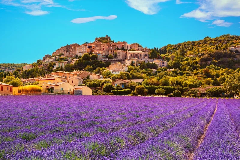
Via Sault: The gentle route
This is the most gradual approach, spanning 25 kilometers (15.5 miles) with a very manageable slope. The plateau of Sault, famous for its lavender fields, provides a classic Provençal backdrop before you begin the ascent.
Pro tip: The summit road can be closed from mid-November to mid-April depending on weather conditions. In the summer, leave early in the morning to beat the intense heat and crowded parking lots. The mistral wind can gust up to 250 km/h (155 mph) at the peak, so always check the forecast on the official mountain weather website before you head out.
At the summit: A panorama across three regions
The orientation table helps you identify landmarks in the distance. On clear days, your view stretches from Mont Blanc to the Pyrenees, and from the Cevennes to the Mediterranean. The weather observatory and the telecommunications tower mark the highest point. A memorial honors the British cyclist Tom Simpson, who died on these slopes during the 1967 Tour de France.
What to look for from the summit terrace:
- The Dentelles de Montmirail, a jagged limestone range to the southwest
- The Alpilles and the Luberon on the horizon
- The Rhône valley and the chain of the Alps on clear days
- The gorges de la Nesque, a dramatic canyon carved into the base of the massif
Flora and fauna: A mix of climates
Chamois have made their home on the northern slope. They coexist with hikers without showing much fear. In the rocky scree at the summit, about 60 rare plant species have found refuge, including the blue-flowered Reuter's columbine and prickly sea holly. Botanists come from all over the world to observe this mosaic of habitats where alpine flora survives just a few miles from Mediterranean olive trees.
Opening hours
*Information subject to change

The view from the top of Mont Ventoux is truly exceptional. To get there, you will need to start a hike that remains accessible with a little effort. In the summer, leave early in the morning and bring plenty of water because of the heat. It is also possible to get there by car, but it is less fun.