
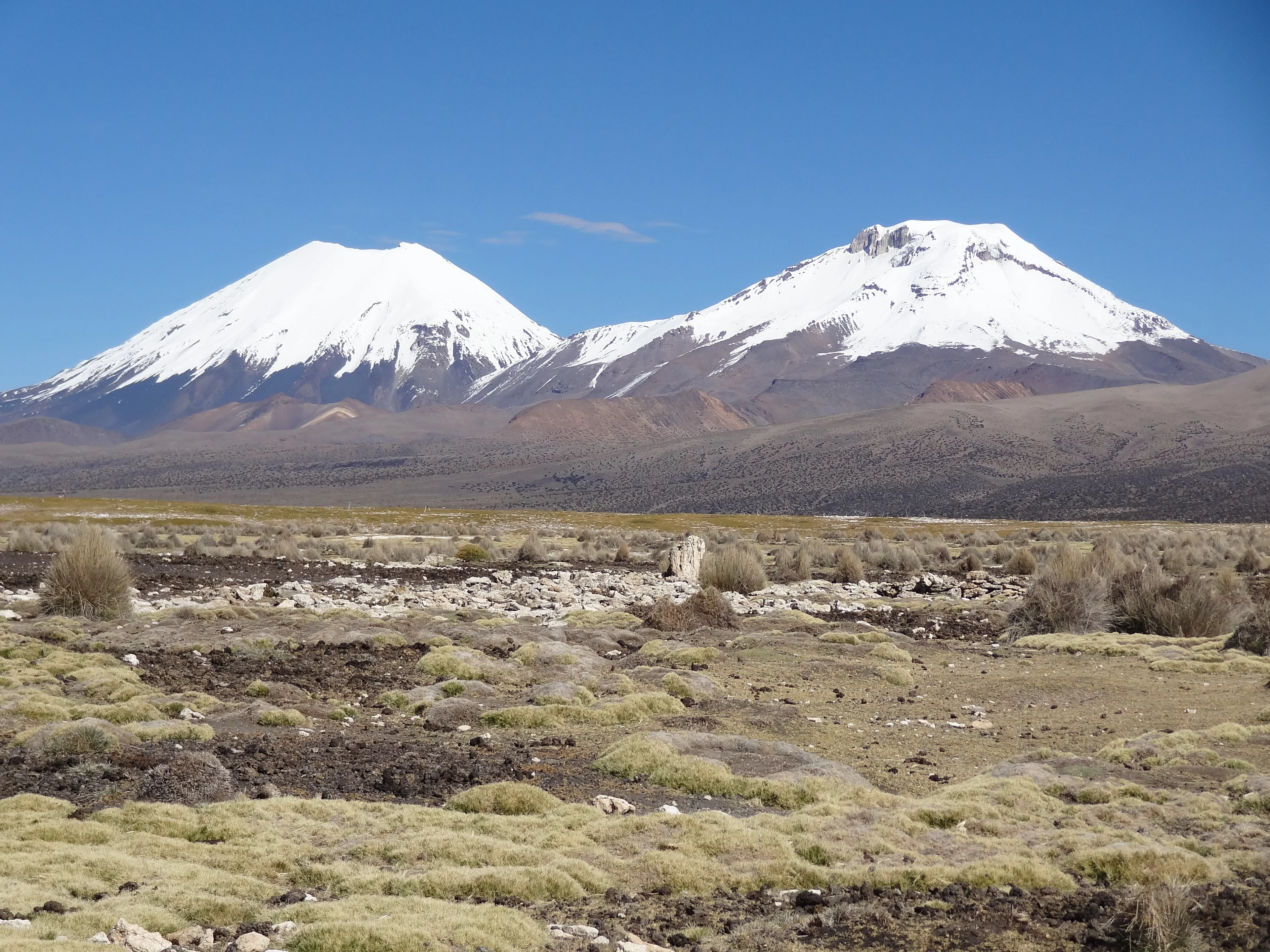
Where to stay near Sajama National Park: the 3 areas to know in 2026
Photo : Thaki Voyage
Let us start with what this page cannot do: we have no room to open for you here. Around the oldest protected park in Bolivia, created in 1939, no address is bookable from home, and the few houses that take in travellers belong to the villages. What the page can do is say what the choice of village changes, because at this altitude that choice weighs more than anywhere else.
The heights of the park run from 4,200 to 6,600 metres, and the Nevado Sajama peaks at 6,542, the highest summit in the country. Our member gives the key to the stay: « I highly recommend that you have a local guide accompany you ». Three villages share the nights: Sajama at the foot of the cone, Tomarapi on the other side, and Curahuara de Carangas 65.4 kilometres away, with its church.
Compare hotel prices near Sajama National Park
In a hurry? Find the best accommodation deals in 3 clicks.
Compare live deals from Booking, Expedia, Agoda and other partners.
The two ways to stay near Sajama National Park
The two villages of the park look at the same volcano from two faces, and the only thing that really separates them is what lies around.
| What changes | In the village of Sajama | In Tomarapi |
|---|---|---|
| To the park marker | 24.7 kilometres, 39 minutes | 6.2 kilometres, 16 minutes |
| The Tambo Quemado border | 23.1 kilometres, 26 minutes | Through the village of Sajama |
| The Chilean park of Lauca | 68.2 kilometres, 63 minutes | Further still |
| The thermal springs and the geysers | In the park, around the village | South of the cone |
| Bookable rooms | None, on our side | None, on our side |
| The altitude of the night | Above 4,200 metres | Above 4,200 metres |
| The road from La Paz | 277.6 kilometres, 4 hours 29 minutes | Eighteen kilometres more |
| For whom | Anyone walking and crossing the border | Anyone who wants the north face and nobody |
How long to the entrance, area by area?
These distances are ROAD distances, counted from the village of Sajama, the one most visitors reach first; the note on each line gives the marker the park listing carries, inside the massif. The departure cities are far off: Oruro 213.2 kilometres away, La Paz 277.6.
| From | Time | How |
|---|---|---|
| The village of Sajama, at the foot of the cone | on site | at the foot of the cone The listing marker is 24.7 kilometres and thirty-nine minutes away. |
| Tomarapi, on the other side of the volcano | 18.9 km, 24 min | around the north of the cone The listing marker is only 6.2 kilometres and sixteen minutes away. |
| Curahuara de Carangas, and its church | 65.4 km, 70 min | Patacamaya road Patacamaya is 179 kilometres from the village, and La Paz 277.6. |
At a glance: our picks by traveller type
Pick the profile that fits you and go straight to the recommended area.
Map of the areas near Sajama National Park
See how the areas sit relative to one another before choosing your base. Click a name to jump to its description.
The village of Sajama, at the foot of the cone 23.1 kilometres from the Tambo Quemado border post
Anyone setting off at dawn to walk below the volcano
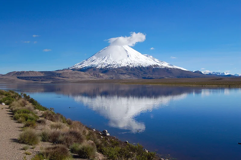
This is the village of the park, set at the foot of the cone, and the starting point for the walks, the thermal springs and the geysers of the Wallaqueri area. The Tambo Quemado border is 23.1 kilometres and twenty-six minutes away, and the Chilean park of Lauca 68.2 kilometres: anyone sleeping here can cross from one park to the other in a day. We have no bookable address to offer you: the houses that take guests are the ones belonging to the village.
To really enjoy your visit, I highly recommend that you have a local guide accompany you
Other things to do in this area
Pros
- The foot of the cone, and the walks that leave from it
- The thermal springs and the geysers of the park
- Twenty-six minutes from the Chilean border
Cons
- No room bookable from home
- A night above 4,200 metres, from the very first one
Tomarapi, on the other side of the volcano 18.9 kilometres from the village of Sajama, 24 minutes
Anyone who wants the north face and the silence
Eighteen kilometres and twenty-four minutes separate the two villages, and they are two faces of the same volcano: Tomarapi looks at the cone from the north, and no village lies closer to the marker the park listing carries: 6.2 kilometres and sixteen minutes. The village is tiny and the welcome is run by the community. Here too, we have nothing to open for you: the night is settled on the spot.
Pros
- The north face of the cone, sixteen minutes from the park marker
- A tiny village, so nobody
- Twenty-four minutes from the village of Sajama
Cons
- No room bookable from home
- Nothing but the village and the volcano
Curahuara de Carangas, and its church 65.4 kilometres from the village of Sajama, 70 minutes
Anyone arriving by road who wants to break the trip
The seat of the municipality the village of Sajama belongs to, 65.4 kilometres and seventy minutes from it, on the road that comes from Patacamaya. Its church, which people call the Sistine Chapel of the Andes, is the reason to stop here. Coming from La Paz, Patacamaya is 179 kilometres from the village of Sajama, and the whole trip takes 4 hours 29 minutes: breaking it here makes sense.
Pros
- The church called the Sistine Chapel of the Andes
- The seat of the municipality, on the Patacamaya road
- Seventy minutes from the village of Sajama
Cons
- No room bookable from home
- Seventy minutes of road before the volcano
Our tips for booking the right place
- What this page cannot do, and why it says so: None of the addresses in the villages of the park is bookable from home: we therefore have no button to offer you, and we would rather write it than let you search. The only listings that answer to the word Sajama are hotels in La Paz, 277.6 kilometres and 4 hours 29 minutes of road away. What you will find on site, in the village of Sajama as in Tomarapi, are houses that take in travellers, run by the villages themselves. This page therefore serves another purpose: choosing the village, and knowing what the altitude imposes.
- Four thousand two hundred metres from the first night: The heights of the park run from 4,200 to 6,600 metres, and the two villages stand at the bottom of that range: the night is therefore spent higher than the highest summit of the Austrian Alps. For anyone arriving from La Paz, already at altitude, the step up is small; for anyone arriving from Arica or Iquique, at sea level, it is brutal and is paid for on the first night. That is why Curahuara de Carangas, 65.4 kilometres away, is worth knowing: breaking the drive there avoids stacking the road and the altitude on the same day.
- The local guide, and what our member says about it: « To really enjoy your visit, I highly recommend that you have a local guide accompany you », writes Bill, and no other sentence on this page is as concrete. The park has neither signposted trails nor a reception centre: what it has are thermal springs, geysers in the Wallaqueri area, polychrome chullpas, rock paintings and pucaras, and none of these places is found on your own. Our member lists what the visit turned up: « llamas, their cousins the alpacas and vicuñas, picturesque villages, warm locals, grandiose landscapes, and distant horizons ».
- Two parks, one border, twenty-six minutes: The Tambo Quemado post is 23.1 kilometres and twenty-six minutes from the village of Sajama, and on the other side begins the Chilean national park of Lauca, 68.2 kilometres and sixty-three minutes away. Both protect the same altiplano, and Lake Chungará sits just beyond the border. Sleeping in the village of Sajama is therefore the only way to see both in the same day: from Tomarapi, you first have to cover the eighteen kilometres back to the village.
- The oldest park in the country, and what it protects: Created on 2 August 1939, the Sajama is the first protected area in Bolivia, and our member knows it: « the oldest natural park in Bolivia ». It covers 200,000 hectares across the municipalities of Curahuara de Carangas and Turco, in the north-west of the Oruro department, and it is run by the national protected areas service. What it protects comes down to the altitude: queñua forests, among the highest in the world, high-altitude wetlands, vicuñas, suris and Andean cats. The Nevado Sajama, for its part, peaks at 6,542 metres.
- Looking for a bookable room in the villages of the park: there is none on our side.
- Stacking the drive up from sea level and a night at 4,200 metres: the altitude is paid for the same evening.
- Counting on signposted trails: the park has none, and our member recommends a local guide.
- Planning the Chilean park of Lauca from Tomarapi: you first have to cover the 18.9 kilometres back to the village of Sajama.
FAQ: where to stay near Sajama National Park
Can you book a room near the park?
Which village should we choose, Sajama or Tomarapi?
At what altitude do you sleep?
Do you need a guide?
How do you get there?
What is there to see in the park?
Hotels available near Sajama National Park, on the map
Tonight's availability and prices, hotel by hotel, at the distance you choose.
Compare live deals from Booking, Expedia, Agoda and other partners.
 Keep exploring
Everything about Sajama National Park: reviews, photos, practical info
Comments (0)
No comments yet. Be the first!