
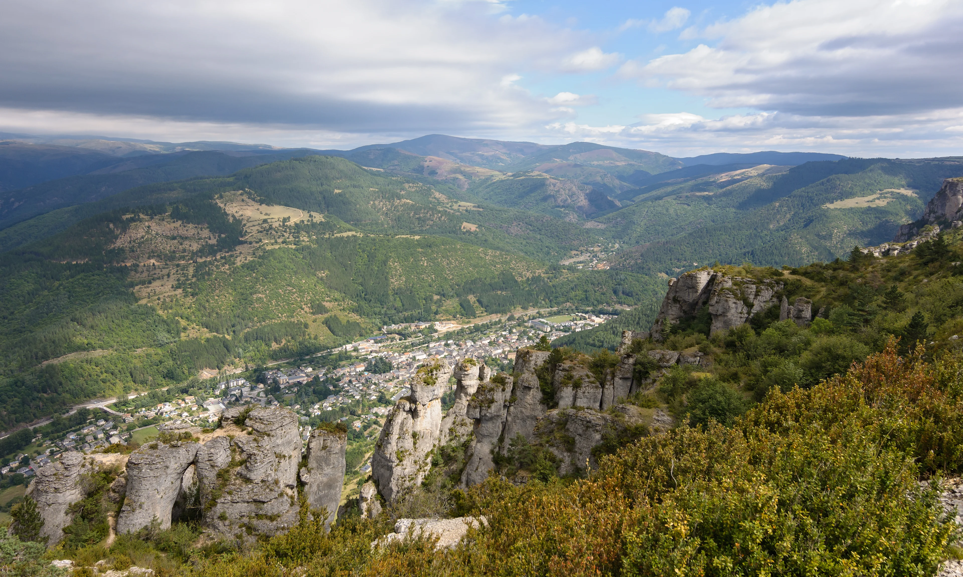
Where to stay near Cévennes National Park: the 2 areas to know in 2026
From Meyrueis to the summit of Mont Aigoual, there are 13.5 kilometres as the crow flies and 26.2 kilometres by road, which is 24 minutes. From Montpellier to Meyrueis, 72.4 kilometres as the crow flies and 124.7 kilometres by road, which is 114 minutes. The relief doubles the distances, and it is what decides your day: the park's four areas, Mont Lozère, Mont Aigoual, the Causses and Gorges and the Cévenol Valleys, cannot be visited from the same room.
Second thing, and it happens at night: the park is the largest International Dark Sky Reserve in Europe, 3,560 square kilometres certified in 2018. FloraC, who lived nearby, had said it before the label: « if you have an adventurous soul, the stars are superb at night! ». Laure D warns for her part that you hike here « through chestnut forests with no cell service and without running into anyone ».
Compare hotel prices near Cévennes National Park
In a hurry? Find the best accommodation deals in 3 clicks.
Compare live deals from Booking, Expedia, Agoda and other partners.
The two ways to stay near Cévennes National Park
The park has no entrance ticket: what is being decided here is which of its areas you will be close to, and the relief has its say. The two columns below do not give access to the same landscapes within the same day.
| What changes | In Meyrueis | In the valleys |
|---|---|---|
| To the Aigoual summit | 26.2 kilometres, 24 minutes | 66.4 kilometres, 70 minutes |
| The city you set out from | Montpellier, 114 minutes | Nîmes, 47 minutes |
| The Causse Méjean | 16.5 kilometres from the park's point | Behind the ridges |
| The scores served | 8.5 and 8.3 | None, and it is explained below |
| The number of reviews | More than 209 and more than 279 | 311 |
| Sleeping inside the park itself | At the gates of the massif | Our address is inside it |
| The number of addresses | Two | One |
| Who it suits | Anyone coming for the summits | Anyone coming for the chestnut trees |
How long to the entrance, area by area?
The kilometres and minutes below are CAR routes, calculated on the road network, and they come with their straight line: it is the gap between the two that tells you about the Cévennes better than any sentence.
| From | Time | How |
|---|---|---|
| Meyrueis, at the foot of Mont Aigoual | 26.2 km | by car to the summit, 24 minutes 13.5 kilometres as the crow flies, so almost double by road. |
| The Cévenol valleys, from Anduze to Saint-Jean-du-Gard | 66.4 km | by car to the summit, 70 minutes Saint-Jean-du-Gard is 14.1 kilometres and 17 minutes from Anduze. |
At a glance: our picks by traveller type
Pick the profile that fits you and go straight to the recommended area.
Map of the areas near Cévennes National Park
See how the areas sit relative to one another before choosing your base. Click a name to jump to its description.
Meyrueis, at the foot of Mont Aigoual 12.2 kilometres from the park's reference point
Anyone coming for the Aigoual and the causses
Meyrueis is the western gateway to the Aigoual massif: 12.2 kilometres as the crow flies from the park's reference point, and 26.2 kilometres by road to the summit, which is 24 minutes for 13.5 kilometres in a straight line. ValNomad made that climb another way: « I was lucky enough to climb Mont Aigoual by bike. It was a demanding climb, but the breathtaking views were a great reward ». From this side, the Causse Méjean is 16.5 kilometres away and Florac 34.9 kilometres by road, 35 minutes.
My favorite part is the Causse Méjean, with its cliffs and many vultures soaring overhead!
Where to stay in this area
Hotel Saint-Sauveur Mid-range
8.5 across more than 209 reviews, cleanliness 9.3, location 9.2 and value for money 8.6: in the heart of the village of Meyrueis, and its own listing warns that it has no parking.
Chateau d'Ayres city.oudormir_tier_haut
8.3 across more than 279 reviews, staff 9.3 and location 9.2: 11.3 kilometres from the park's reference point, 27.2 kilometres by road from the Aigoual summit, with two heated pools, one of them indoors.
 Stay in the city
Where to stay in Montpellier
Montpellier has its own guide: neighbourhoods, prices, our recommended hotels.
Pros
- The Aigoual summit 24 minutes away by road
- The Causse Méjean 16.5 kilometres away
- Two addresses with more than 209 reviews each
Cons
- 114 minutes of road from Montpellier
- 35 minutes of road to Florac
The Cévenol valleys, from Anduze to Saint-Jean-du-Gard The slope that drops towards the plain
Anyone arriving via Nîmes who wants the chestnut trees
This is the other gateway, the one Laure D describes: « Around Ganges, which is more accessible from Montpellier, or Saint-Jean-du-Gard and Anduze, which are easier to reach from Nîmes, the landscapes are splendid and provide a real change of scenery ». The figures bear her out: Nîmes is 45.6 kilometres and 47 minutes from Anduze, while Montpellier is 114 minutes from Meyrueis. In exchange, the Aigoual summit is far: 66.4 kilometres and 70 minutes from our address in Anduze. Saint-Jean-du-Gard follows at 14.1 kilometres, 17 minutes.
If you love wide open spaces and are ready to hike through chestnut forests with no cell service and without running into anyone, take a trip to the Cévennes.
Where to stay in this area
Logis Hôtel Restaurant Le Pradinas Mid-range
311 reviews, staff at 9.6 and location at 9.4: a former silkworm farm from the 18th century at 4377 route de Générargues, in Anduze, inside the national park, 35.5 kilometres from this page's reference point.
 Stay in the city
Where to stay in Nimes
Nimes has its own guide: neighbourhoods, prices, our recommended hotels.
Pros
- 47 minutes of road from Nîmes
- Saint-Jean-du-Gard 17 minutes away
- An address that is inside the national park
Cons
- 70 minutes of road to the Aigoual summit
- A single address served on this side
Our tips for booking the right place
- The relief doubles the distances, and that can be measured: From Meyrueis to the summit of Mont Aigoual: 13.5 kilometres as the crow flies, 26.2 kilometres by road, 24 minutes. From Montpellier to Meyrueis: 72.4 kilometres as the crow flies, 124.7 kilometres by road, 114 minutes. From Meyrueis to Florac: 20.8 kilometres as the crow flies, 34.9 kilometres by road, 35 minutes. None of these roads is long in kilometres, and every one of them eats a morning there and back. That is why this page talks about gateways rather than distance to the centre: the page's reference point is 8 kilometres from Mont Aigoual, but nobody sleeps in the middle of the park.
- The largest dark sky reserve in Europe, and our reviews had seen it: The park has held the International Dark Sky Reserve label since 13 August 2018, confirmed on 5 August 2022 by the International Dark-Sky Association, across 3,560 square kilometres: it is the largest in Europe. FloraC, who lived nearby, writes it without citing the label: « if you have an adventurous soul, the stars are superb at night! ». The consequence for choosing a room is a concrete one: an address you can step out of in the evening beats an address that forces you back into the car, because the show starts when driving gets difficult.
- Four areas, and they are not visited on the same day: The park's manager distinguishes four: Mont Lozère, Mont Aigoual, the Causses and Gorges, the Cévenol Valleys. Our reviews separate them too. JeromeA: « My favorite part is the Causse Méjean, with its cliffs and many vultures soaring overhead! ». ValNomad climbed the Aigoual by bike. Laure D talks about the chestnut forests of the valleys. The distances follow: the Causse Méjean is 16.5 kilometres from the reference point, Mont Lozère 28.5, Anduze 35.8, and Le Pont-de-Montvert, at the foot of the Lozère, 25.2. Two nights in one place cover one area, not the park.
- The two gateways, described by one of our members before us: Laure D, who knows both slopes, writes: « Around Ganges, which is more accessible from Montpellier, or Saint-Jean-du-Gard and Anduze, which are easier to reach from Nîmes, the landscapes are splendid and provide a real change of scenery ». The roads bear her out: Nîmes is 45.6 kilometres and 47 minutes from Anduze, while Montpellier is 124.7 kilometres and 114 minutes from Meyrueis. So if you arrive via Nîmes, sleeping in the valleys saves you crossing the massif; if you arrive via Montpellier, it is the causses side that moves closer.
- No phone coverage, and it is one of our members who says so: Laure D writes that you hike here « through chestnut forests with no cell service and without running into anyone », and sums up the rest in one line: « Here, nature doesn't cheat ». ValNomad says the same thing differently: « You can really breathe the fresh air there, far from the hustle and bustle ». FloraC adds that « Every hiking trail holds surprises ». What that changes for a room: the addresses on this page are in villages, not on the ridges, and the phone comes back there. The park is also a World Heritage Site as the « Causses and Cévennes », and no national park is larger in mainland France.
- Sleeping in the valleys while counting on climbing the Aigoual every morning: 70 minutes of road, and as much on the way back.
- Judging the distances on a map: from Meyrueis to the summit, the road is almost double the straight line.
- Arriving via Montpellier to sleep on the causses side: there are 114 minutes of road to Meyrueis.
- Counting on your phone while hiking: our member warns there is no coverage in the chestnut forests.
FAQ: where to stay near Cévennes National Park
Where should you sleep to visit the Cévennes National Park?
Meyrueis or the Cévenol valleys?
Can you see the stars from the park?
How long should you allow?
Is there phone coverage?
Do you have to pay to enter the park?
Hotels available near Cévennes National Park, on the map
Tonight's availability and prices, hotel by hotel, at the distance you choose.
Compare live deals from Booking, Expedia, Agoda and other partners.
 Keep exploring
Everything about Cévennes National Park: reviews, photos, practical info
Comments (0)
No comments yet. Be the first!