Château d'Hyères, a forgotten sentinel over the Mediterranean
The motto carved into the entrance sets the stage: Arearum Castrum, the castle of the area. The name feels like a relic of the Middle Ages, when this fortress stood among the most formidable in Provence. Today, only weathered stone walls remain on the Castéou hill, 198 meters above sea level. It is precisely these ruins, suspended between the sky and the sea, that command attention.
Why hike up to the Château d'Hyères?
You do not come here for furnished halls or permanent exhibits. The castle was dismantled in 1620 by order of Louis XIII, who no longer tolerated the independence of the Provençal nobility. The current remains reflect the military architecture of the 13th century, a time when Charles I of Anjou transformed the modest fortress of the lords of Fos into a regional stronghold.
The real reward is at the summit. The 360-degree panorama takes in the bay of Hyères, the Giens peninsula, and the silhouettes of the Golden Islands: Porquerolles, Port-Cros, and Le Levant. Two orientation tables help you identify the landscape. On a clear day, the horizon seems to stretch on forever.
A steep climb through the old town
The most memorable way to reach the top is through the medieval center. Starting from place Massillon (Massillon Square), follow the narrow, winding cobblestone streets. The tour des Templiers (Templars' Tower) marks your first stop before the incline becomes noticeably steeper. Plan for 20 to 30 minutes of walking, which will definitely get your heart rate up.
The path winds through the parc Saint-Bernard (Saint-Bernard Park), a designated Jardin Remarquable (Remarkable Garden), where over a thousand plant species line the trail. Further up, you will pass the Villa Noailles, a 1920s Cubist masterpiece designed by Robert Mallet-Stevens. The route perfectly blends medieval history, botany, and modern architecture.
Insider tip: There is a small free parking area at the summit, accessible by car via rue Saint-Pierre. However, hiking up remains the most rewarding option, especially in the late afternoon when the golden light hits the stone walls.
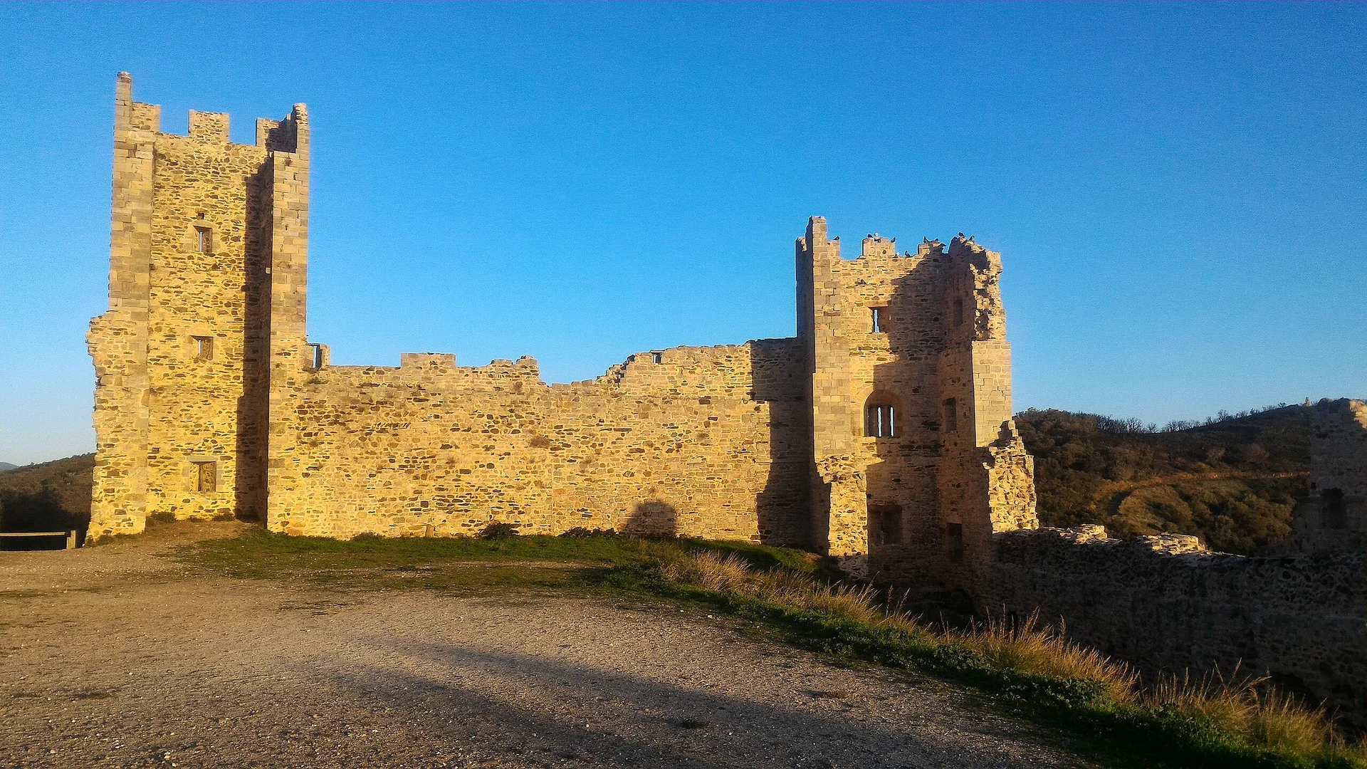
Exploring the ruins
The three entrance towers were restored in the 2000s. You are free to wander between the thick walls, walk through arched passageways, and visualize the scale of the original fortress. Information plaques throughout the site provide historical plans and reconstructions.
Strategic viewpoints
The Vigie, located at the highest point, offers the clearest view. Looking south, the sea sparkles all the way to the islands. To the north, the Maures hills roll under the pine trees. The site is now part of the Parcours des Arts (Arts Trail) of Hyères and occasionally hosts temporary exhibitions within its fortified walls.
The rampart trail
A path circles the exterior of the ruins. The terrain is more uneven here, with winding sections that require sturdy footwear. This loop allows you to see portions of the curtain walls and secondary towers that are rarely photographed. It adds about 15 minutes to your visit.

Ready, set, go!
Here you are, storming the slopes of the castle. It is a tough climb, but it is worth the effort!
I really like getting to this iconic spot in town by taking the steep little alleyways of old Hyères.
Once at the top, you will see some beautiful ruins, the remains of the castle, although the site is unfortunately not very well set up for visitors.
The highlight is definitely the magical view that takes in the peninsula and the islands. It is a must-see!